

Beinn Sgorabhaig [Ben Scoravick] [Beinn Scorabhaig]
Good walks are even better shared.
Overview
Beinn Sgorabhaig: A Highland Gem
Beinn Sgorabhaig, part of the breath-taking Scottish Highlands, rises majestically to an elevation of 705 meters. This Munro offers not only a physical challenge, but also a feast for the eyes—if you can catch a glimpse through the midge-filled air!
Geology
The mountain is primarily composed of ancient gneisses and schists, weathered over millennia. Each rock formation tells a story over a cup of tea or perhaps a dram or two.
Routes
There are two popular routes to the summit: the Eastern Approach from Loch Nevis, a moderate hike covering about 12.5 km, and the Western Ridge from Inverie, which is a shorter, yet considerably steeper ascent. Remember to check the weather before setting off, as the Scots say, "If you don’t like the weather, wait five minutes!"
Summit Features
The summit is adorned with a stone cairn and a trig point, ideal for those Instagram posts—or just for a moment of reflection on your journey.
Terrain
Expect rocky trails with occasional grassy patches—perfect for those who enjoy varied terrains. Just keep your eye out for the offbeat bogs!
Views
The views from Beinn Sgorabhaig are nothing short of spectacular. On a clear day, you can see the entire Knoydart Peninsula and Loch Nevis, which is officially classified as a ‘wow’ zone.
Access
Nearest parking is at Inverie, which gets filled up faster than a Scottish loch in spring. The journey begins with a ferry from Mallaig, adding a touch of adventure before you even hit the trail.
Facilities
Inverie hosts a small shop and the famous Old Forge pub, the most remote pub in mainland Britain, where weary hikers can replenish their spirits.
History
With its Gaelic name translating to ‘Hill of the high peak’, Beinn Sgorabhaig is steeped in historical significance, having been a stronghold for the Highland clans of yore.
Whether you're chasing the wind or just need a break from it all, Beinn Sgorabhaig has all the elements to make your outdoor adventure unforgettable—even if you come just for the pub at the end of it all!
Explore routes near Beinn Sgorabhaig [Ben Scoravick] [Beinn Scorabhaig]
Public walks starting within 80 km of this hill. Nearby does not mean a route reaches the summit; check its map and access before setting out.
Beautiful private beach walk Isle of Harris
View route
Berneray Community Hall to the beautiful beach
View route
Fairy Lochs Liberator Wreckage Circuit
View route
Route planning notes
These notes describe possible approaches, not verified navigable routes or permission to cross land. Check current paths, local access rules and conditions before setting out.
Eastern Approach from Loch Nevis
A scenic route beginning at the shore of Loch Nevis, offering breathtaking views of the surrounding landscape as it winds up to the summit.
Western Ridge
A shorter yet steeper ascent starting from the small hamlet of Inverie, providing direct access to the summit with some challenging sections.
Make a day of it, together
Find someone to share the walk with, or organise a day out along a route you like.
Photo Gallery
View all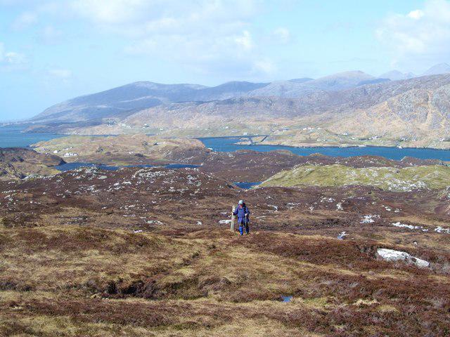 Photo could not load
NG2395 : On the path to Beinn Sgorabhaig
Gordon Hatton
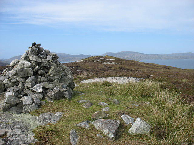 Photo could not load
NG2395 : Beinn Scoravaig, Scalpay
David Purchase
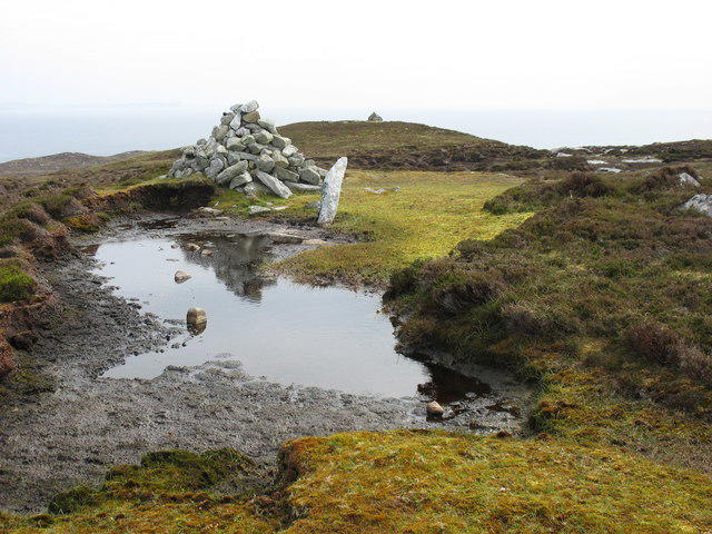 Photo could not load
NG2395 : The summit of Beinn Scoravaig, Scalpay
David Purchase
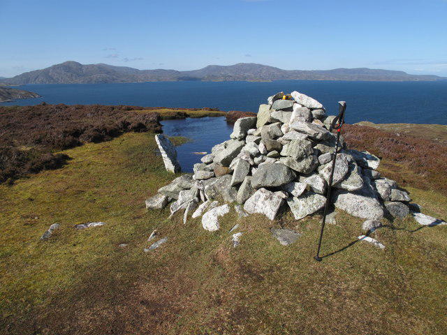 Photo could not load
NG2395 : Ben Scoravick [Beinn Scorabhaig] [Beinn Sgorabhaig]
Rude Health
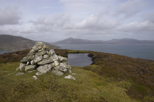 Photo could not load
NG2395 : Summit cairn on Beinn Sgorabhaig
Tom Richardson
Hill facts and local notes
Classifications
Elevation
104m
341 ft
Prominence
104m
Coordinates
57.8653, -6.6608
NG236957
OS Map
14
Explorer: 455
At the Summit
The summit features a prominent stone cairn and a trig point, both ideal for a quick selfie or to contemplate life’s pressing questions (such as, 'Why did I wear shorts today?').
Terrain & Geology
Dominated by ancient gneisses and schists, Beinn Sgorabhaig showcases the rugged resilience of Scottish geology with its weathered rock layers and stunning mountain vistas.
Views & Scenery
Panoramic views of Knoydart Peninsula, Loch Nevis, and beyond, making it a photographer's dream and a hiker’s paradise.
History & Heritage
Name Origin
The name 'Beinn Sgorabhaig' loosely translates to 'Hill of the high peak' in Gaelic, a fitting tribute to this majestic mountain.
Historical Significance
Historically, the region was a stronghold for the clans of the Highlands and has witnessed many tales of bravery and intrigue.
Getting There & Facilities
Check current local access restrictions, parking rules and transport timetables before travelling. These notes do not confirm public access to the summit.
Parking
Park at Inverie, where there is limited parking available. Be sure to arrive early, as it fills up faster than a free buffet!
Public Transport
Access via ferry from Mallaig to Inverie, which is a scenic ride in itself and a fine way to start your adventure.
Nearby Facilities
Inverie offers a small shop and the renowned Old Forge pub, where walkers can quench their thirst after a long trek—just remember, it’s the most remote pub in mainland Britain!
Safety Information
Known Hazards
- Watch for sudden weather changes common in the Highlands, loose rocks on steep pathways, and a few friendly midges, just to keep things interesting.
General Safety Tips
- Check weather conditions before setting out
- Carry appropriate clothing and equipment
- Let someone know your planned route
- Take a map, compass, and GPS device
- Carry emergency supplies: food, water, first aid kit, torch
Hills
Some common questions about the hills answered
Are there group walks up Beinn Sgorabhaig [Ben Scoravick] [Beinn Scorabhaig]?
Many walkers use Walkmates to join or organise walks with others. You can check for group walks around Beinn Sgorabhaig [Ben Scoravick] [Beinn Scorabhaig] through the maps
Are there other walkers around Beinn Sgorabhaig [Ben Scoravick] [Beinn Scorabhaig]?
Activity varies by location and time, but Walkmates lets you see whether others have shared walks or shown interest in this area. Find other people through the walking friends search walking friends for Beinn Sgorabhaig [Ben Scoravick] [Beinn Scorabhaig] search or of course create your own walk for Beinn Sgorabhaig [Ben Scoravick] [Beinn Scorabhaig]
Can I organise a walk to Beinn Sgorabhaig [Ben Scoravick] [Beinn Scorabhaig]?
Yes. If there aren’t any walks listed already, you can create a walk and make it available for others to join.
If you're signed up to Walkmates, you can create a walk to Beinn Sgorabhaig [Ben Scoravick] [Beinn Scorabhaig].
How do I find a walk up this hill?
There are often multiple ways to walk this hill, depending on experience and route preference. Walkmates helps you explore walks and routes that others have shared.
Can I suggest a new route up Beinn Sgorabhaig [Ben Scoravick] [Beinn Scorabhaig]?
Yes. You can suggest or create routes to share with others. Walkmates focuses on the social side of walking, so routes are used to help people organise walks and explore areas together, rather than as detailed navigation tools or route libraries.
Other uses really appreciate knowledgeable walkers sharing their routes. Share your favourite route to Beinn Sgorabhaig [Ben Scoravick] [Beinn Scorabhaig] here
The is an error or something incorrect about this hill. How do I let you know?
We always strive to keep the information on Walkmates as accurate as possible. If you find an error, please let us know through the contact form and we'll aim to correct it as quickly as possible
Community Discussion
Comments
Location
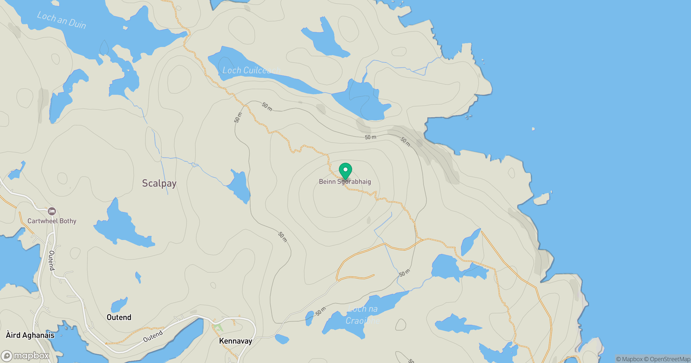
Grid reference: NG236957
View on OpenStreetMapOpens a map in a new tab, centred on the hill.
Hills within 30 km
Straight-line distance, not a walking route or confirmation of access.
An Cliseam [Clisham]
800m
Todun [Toddun]
528m
Cipeagal Bheag [Cipeagil Bheag] [Ciopeagal Bheag]
336m
Beinn Mhor
572m
Muaitheabhal
424m
No comments yet. Be the first.